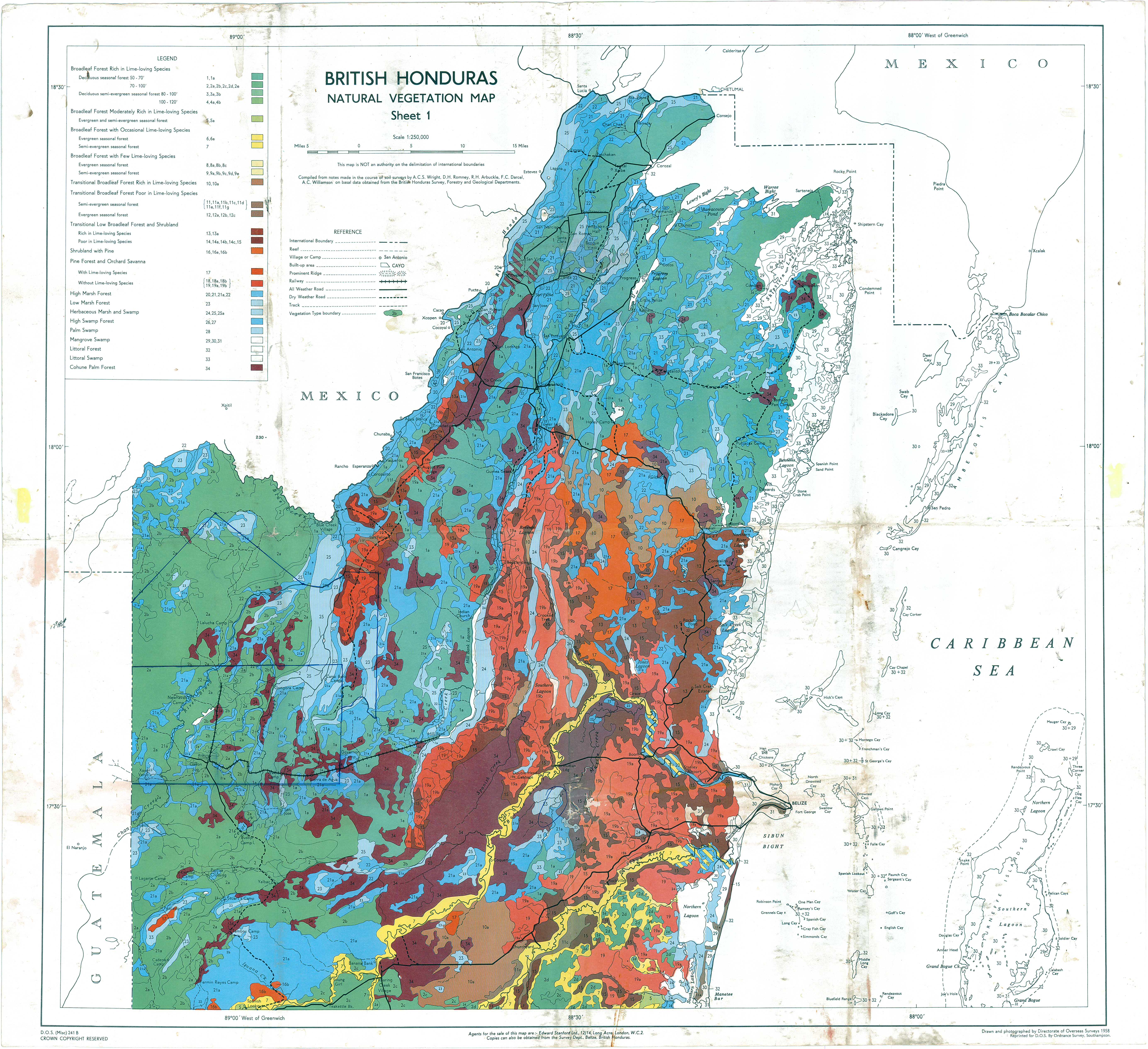
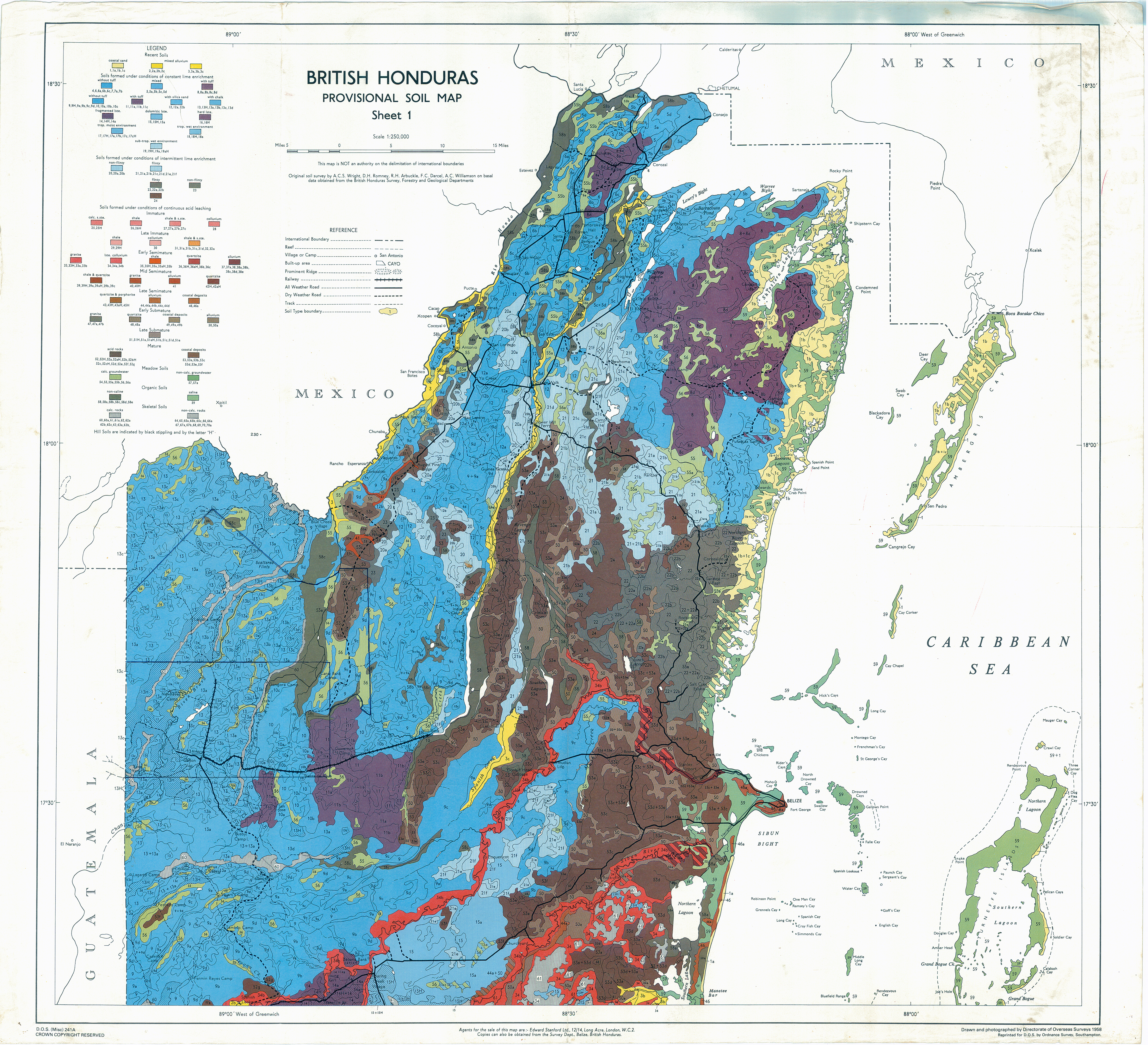
Vegetation and soil maps. For maps of soil and vegetation of northern Belize go to:
Vegetation: https://ecologynwbelize.org/wp-content/uploads/2021/01/wright-natural-vegegation-north-belize.jpg
Soil: https://ecologynwbelize.org/wp-content/uploads/2021/01/wright-soil-north-belize.jpg
Maps used with permission. Maps were published in connection with: Wright, A. C. S., D. H. Romney, R. H. Arbuckle, and V. E. Vial. 1959. Land in British Honduras. Colonial Research Publication No. 24. Her Majesty’s Stationery Office [The National Archives], Surrey, UK.
————————————————————–
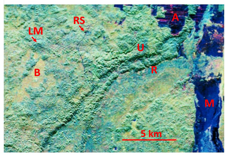
Vegetation types, agriculture, ancient Maya site, and a research station. Compare details in this AIRSAR image with details in Profile (at bottom of page) and see Environment and vegetation page in this website.
————————————————————–
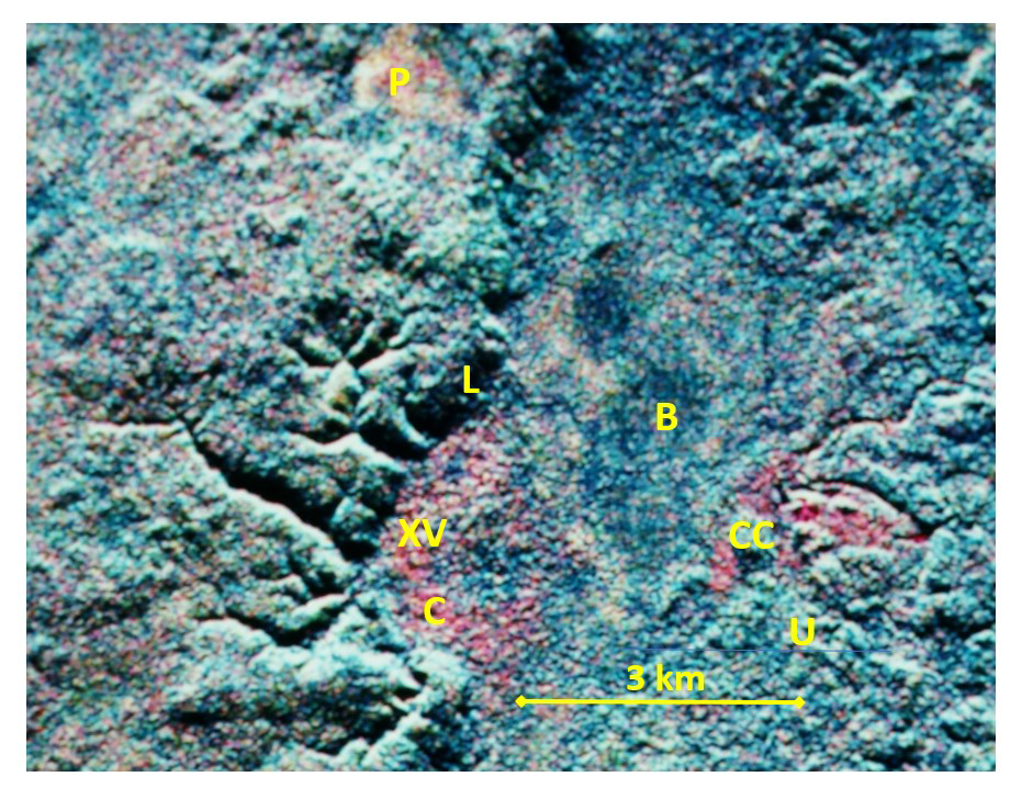
Vegetation types, ancient Maya sites, and a tourist lodge. Compare details in this AIRSAR image with details in Profile (at bottom of page) and see Environment and vegetation page in this website.
————————————————————–
Profile showing relation of vegetation type to topography, soil, and parent material in northwest Belize (from Wright et al. 1959; see above or on Publications page in this website).
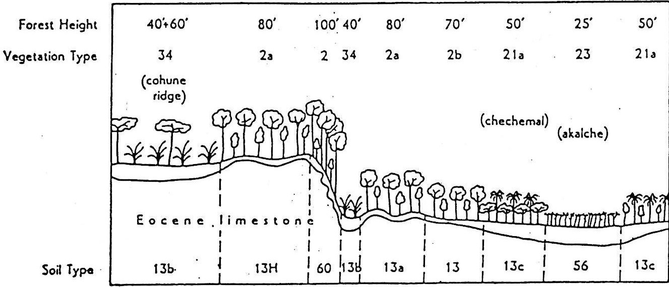
Profile showing correlations among forest height (feet), types of vegetation,topography, and soil in northwest Belize (Wright et al. [1959], page 72; used with permission: The National Archives Image Library, United Kingdom). This diagram accurately shows most relationships between topography and vegetation types in northwest Belize (note exception below). In the key that follows the webpage authors use their names for vegetation types (cf. source document key below); soil key desciptions are from the source document. Relief, soil depths, and heights in the diagram are exaggerated to emphasize variation. See Enivronment and vegetation page in this website for details on vegetation types. KEY: Vegetation types: 2, 2a, 2b, = Upland forest (U on AIRSAR images), note taller forest on slopes; 21a = Botan palm-logwood forest (not truly characteristic of northwest Belize); 23 = Bajo forest (B on AIRSAR images); 34 = cohune palm (Attalea cohune) forest (C on AIRSAR images), or “cohune ridge” in local parlance (not indicating topographic relationship). KEY: Soil types: 13 = clay, 13a = gravelly clay, 13b = dark grey-brown clay, 13c = mottled clay, 13H = gravelly clay loam, 56 = clay, 60 = skeletal soils on steep rugged limestone.
Source document vegetation key. Source document vegetation types are named using common names for prominent tree species in each type. In each type there are many additional tree species (some more abundant than the species listed). Vegetation Types: 2 = SAPOTE-Silion forest(Manilkara spp.-Pouteria amygdalina), 2a = SAPOTE-Silion forest (Manilkara spp.-Pouteria amygdalina) (associated species differ from those in Type 2), 2b = SAPOTE-Ramon-Spice forest (Manilkara zapota-Brosimum alicastrum–Pimenta dioica), 21a = BOTAN-Chechem forest (Sabal mauritiiformis-Metopium brownei), 23 = CHUCUM-Logwood-Palmetto (Havardia albicans-Haematoxylum campechianum–Acoelorraphe wrightii), 34 = COHUNE palm forest (Attalea cohune).
